In the footsteps of Robert Louis Stevenson, on GR70
Looking for outdoor adventure? Walk in the footsteps of Robert Louis Stevenson along the legendary Stevenson Trail! In 1878, the famous Scottish writer embarked on a journey through the wild, forgotten landscapes of France, accompanied by his donkey, Modestine. Today, you can follow his path and hike through the southern Massif Central, from the Velay volcanoes to the chestnut groves of the Cévennes. Don’t wait – lace up your hiking boots and get ready to immerse yourself in the rich local heritage while traversing spectacular landscapes. Here, you’ll find our tips for an unforgettable trekking experience along the Stevenson Trail.
Stevenson, the forerunner of backpacking
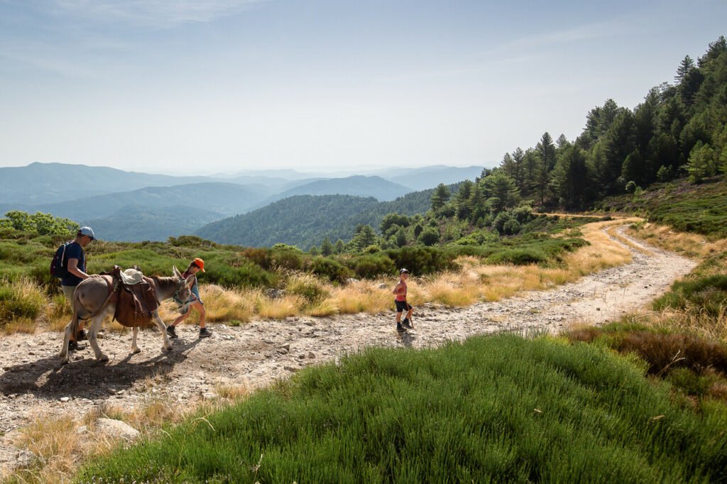
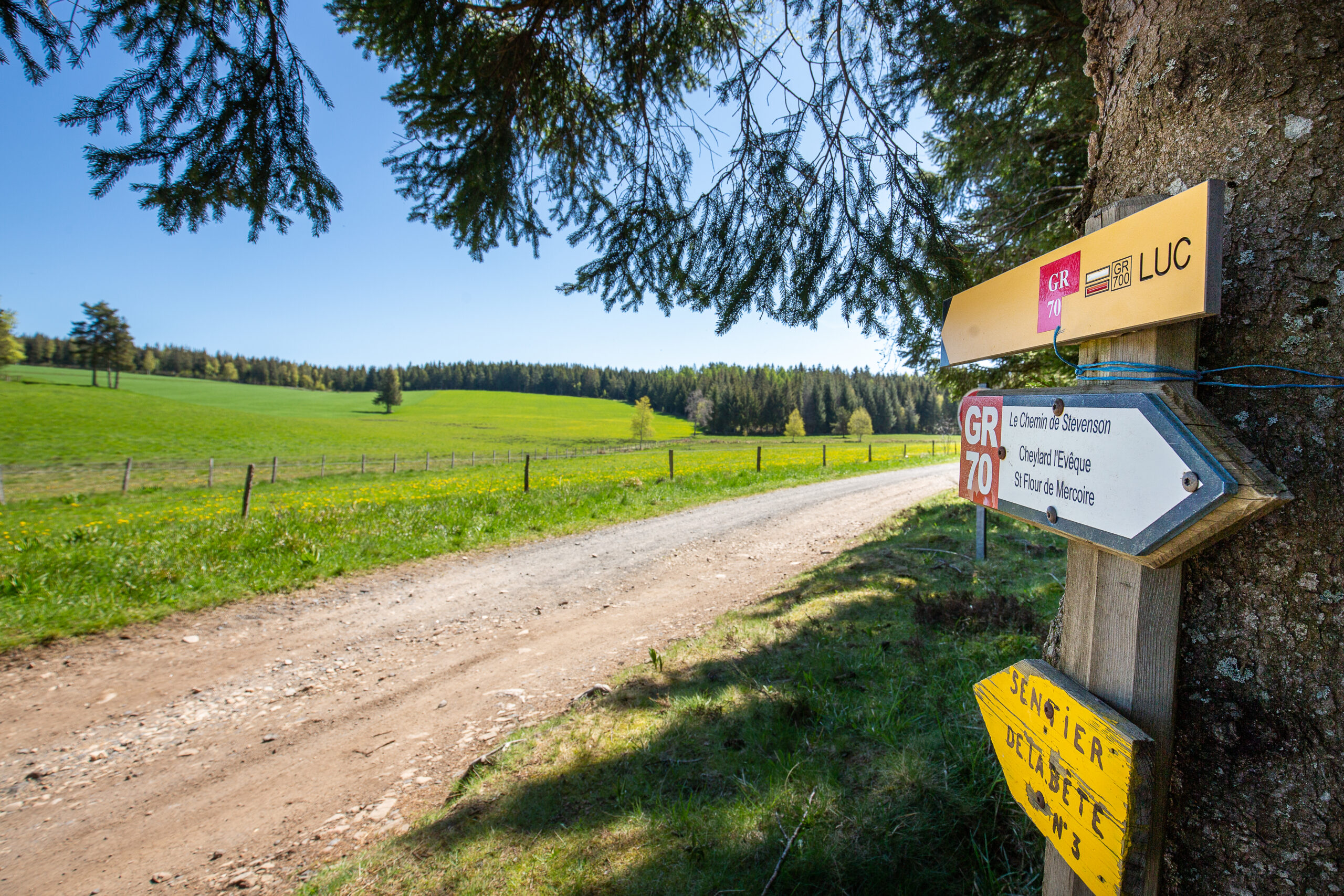
The GR70, or the Stevenson Trail, retraces Robert Louis Stevenson’s journey in 1878, following a painful heartbreak. Inspired by the French Protestant rebels (Camisards) who fought for religious freedom during the 16th-century Wars of Religion, Stevenson set out to explore their land. He started his journey at Le Monastier-sur-Gazeille, accompanied only by Modestine, his donkey. 12 days, 220 km and many adventures later, he reached Saint-Jean-du-Gard, near Alès. Each evening, Stevenson carefully recorded his experiences in a travel journal, which was then published in 1879 as “Travels with a Donkey in the Cévennes”. In 1978, his journey inspired the creation of the GR70, now recognized as a European Cultural Route.
Photo credit : © Benoît Colomb – Lozère tourisme
5 key facts about the Stevenson Trail
> 272 km from Le Puy-en-Velay to Alès
> 4 natural regions: Velay, Gévaudan, Mont Lozère and the Cévennes
> 12 stopovers, with approximately 20 km between each
> 1700 m: the highest point
> A European Cultural Route
Preparing your Stevenson Trail trek
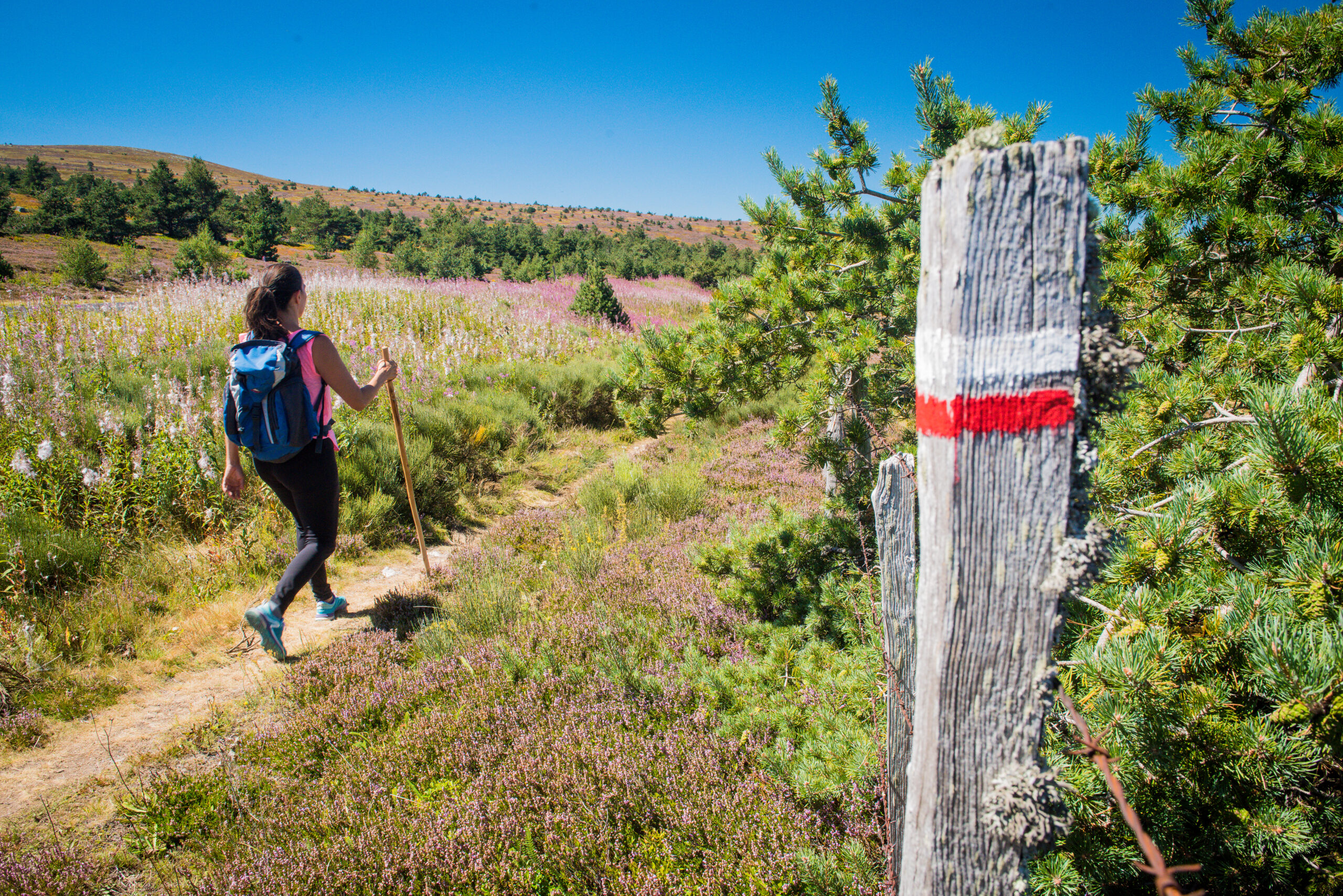
Choose your stopovers along the Stevenson Trail
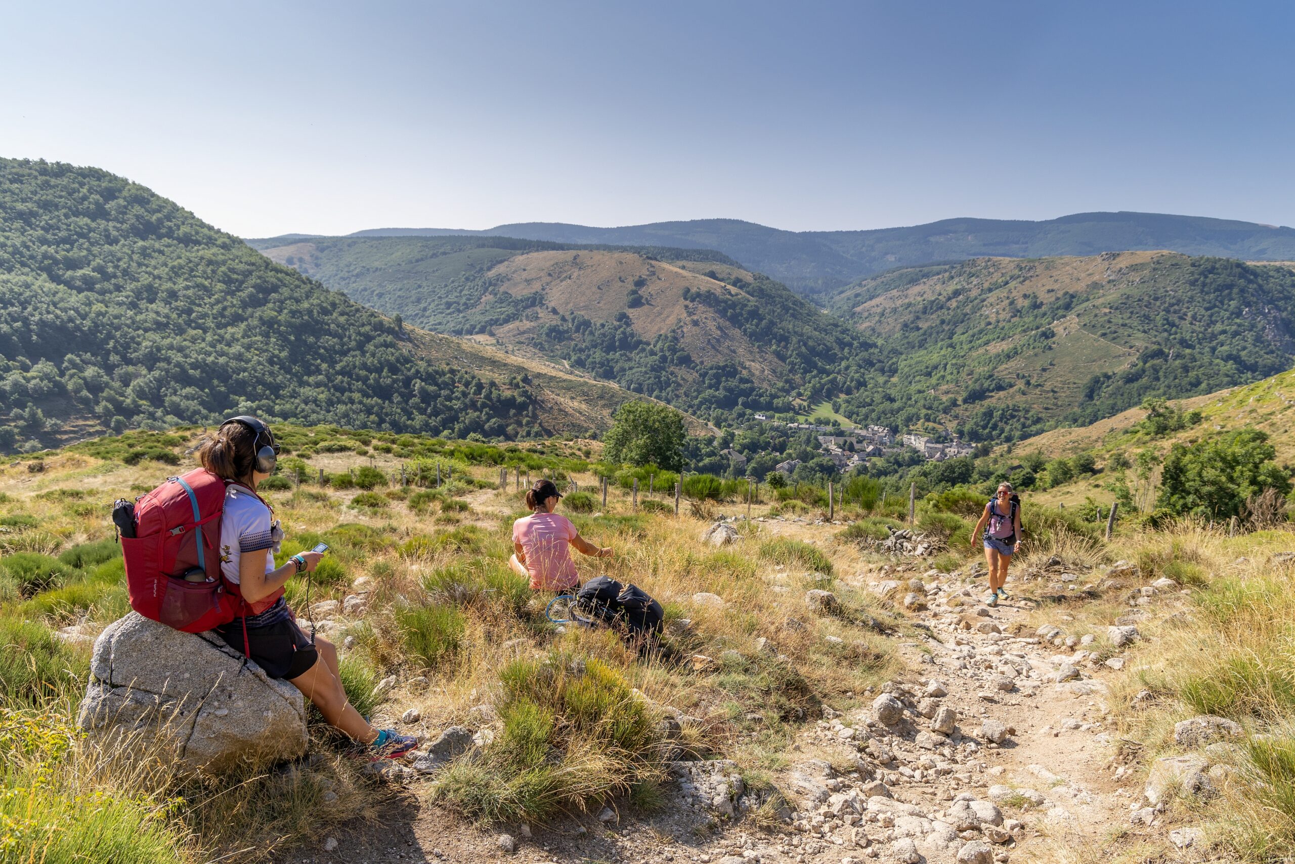
The Stevenson Trail winds its way from Le Puy-en-Velay to Alès. Typically, this long-distance hike is divided into 12 to 14 sections, with approximately 20 km between each stop. But, why not choose a portion of the Trail for a shorter trek? Below you will find our selection of ideas for shorter hikes along the Trail.
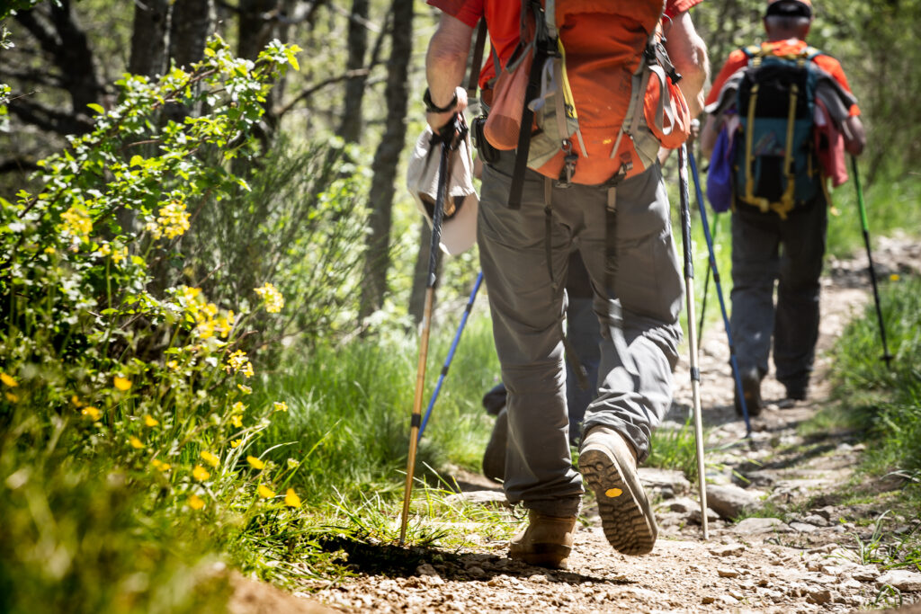
Photo credit: © Benoît Colomb – Lozère tourisme
A selection of section hikes along the Stevenson Trail
> A 3-day hike: Florac – Saint Jean du Gard
Day 1: Florac – Cassagnas: 17,4 km
Day 2: Cassagnas – Saint Germain de Calberte: 15 km
Day 3: Saint Germain de Calberte – Saint Jean du Gard: 21,6 km
> A 5-day hike: Le Pont de Montvert – Alès
Day 1: Le Pont de Montvert – Florac: 28,5 km
Day 2: Florac – Cassagnas: 17,4 km
Day 3: Cassagnas – Saint Etienne Vallée Française: 23,9 km
Day 4: Saint Etienne Vallée Française – Mialet: 20,7 km
Day 5: Mialet – Alès: 24,1 km
> A 6-day hike: Chassèrades – Saint Jean du Gard
Day 1: Chassèrades – Le Bleymard: 17 km
Day 2: Le Bleymard – Le Pont de Montvert: 19,3 km
Day 3: Le Pont de Montvert – Florac: 28,5 km
Day 4: Florac – Cassagnas: 17,4 km
Day 5: Cassagnas – Saint Germain de Calberte: 15 km
Day 6: Saint Germain de Calberte – Saint Jean du Gard: 21,6 km
These are only examples, feel free to compose your own personalized Stevenson Trail section hike.
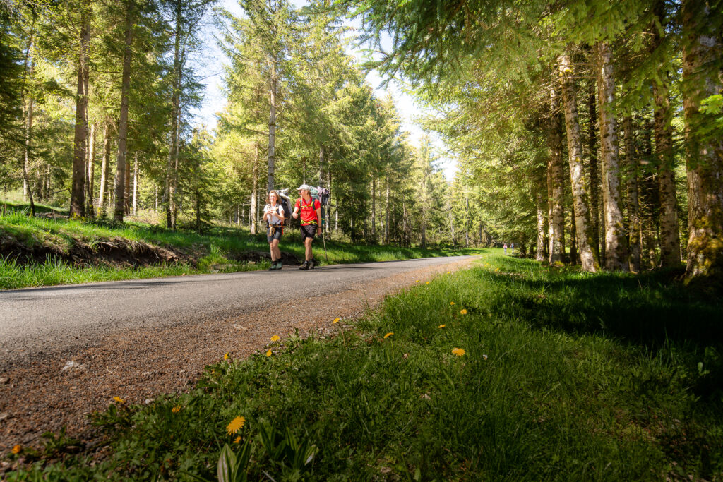
Photo credit: © Benoît Colomb – Lozère tourisme
Prepare your long-distance hike in advance
To help you prepare your trek, we encourage you to contact the Stevenson Trail Association, which publishes free brochures in English and German, with useful information on lodging, transport, restaurants, and more. We also recommend acquiring and bringing along the Stevenson Trail IGN map (available in English), to help with orientation.
When to hike the Stevenson Trail?
We recommend undertaking your long-distance hike along the Stevenson Trail in spring (from May to mid-July) or in autumn (from September to October). During these periods, accommodations are open to visitors, and the weather conditions are favorable for outdoor activities. Summer temperature can be quite hot, which might not be ideal for long-distance hikes. If you would like to hike in summer, it’s preferable to focus on the northern part of the trail.
If you would like to hike in winter, be sure to check the availability of lodging and services. It is also essential to monitor weather conditions before your trip. The Stevenson Trail winds through mid-mountain ranges, reaching the altitude of 1 700 m at its highest point, so adequate winter equipment might be necessary.
Finding Lodging
Where can you sleep along the Stevenson Trail? You will find a variety of accommodations all along your hike, including bed & breakfasts, hotels, hostels, and campgrounds. A selection of hiker-friendly lodging options is listed in the English version of the Stevenson trail brochure (contact the Stevenson Trail Association for a copy).
Reserve in advance, as lodging can be limited in certain sections of the trail and the demand is often high.
Prefer to bivouac?
Yes, you can bivouac along the Stevenson Trail! However, certain rules and regulations apply. Be sure to check our Bivouac in the Cévennes page before embarking on your wild adventure.
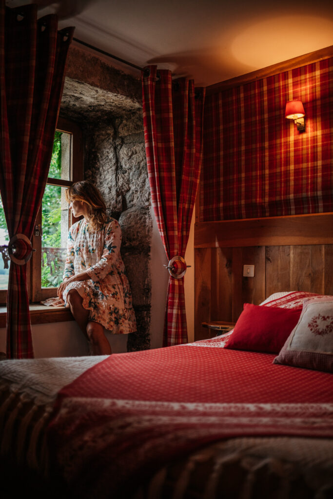
Le Merlet Bed & Breakfast © leblogcashpistache
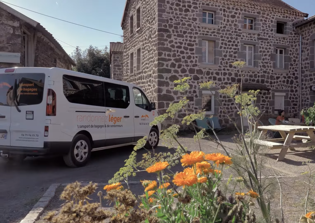
photo credit : © La Malle Postale
Finding Transportation
> Reserve a transportation service for backpackers in advance that can take you back to your starting point.
> Train stations can be found in : Puy en Velay, Langogne, Luc, La Bastide Saint Laurent les Bains, Chasseradès, and Alès
> Regional Lio bus lines :
– 251 : Mende – Florac – Alès
– 282 : Mende – La Bastide – Langogne – Le Puy
– 112 : Saint Jean du Gard – Anduze – Nîmes
– 261 : Florac – Le Pont de Montvert (only in July and August)
– 253 : Mende – Bagnols les Bains – Mont Lozère (only in July and August)
> Municipal Ales’y bus lines :
– 72 : Saint Jean du Gard – Anduze – Alès
– 81 : Saint Jean du Gard – Mialet – Alès
> Reserve a taxi
Luggage transportation
Looking to lighten your load? Reserve with one of our luggage transportation services; they will transport your bags along the Stevenson Trail from one lodging to the next.
Need help planning your trip? Contact us for personalized advice. We are here to answer all of your questions!